The Marlborough Sounds is a series of ancient drowned river valleys which has created a picturesque landscape of lush green vegetation right down to the waterline.

The surrounding lush forest in the Punga Cove area is home to many native plants like Kawakawa in the Marlborough Sounds in New Zealand's top of the South Island

Our Forests

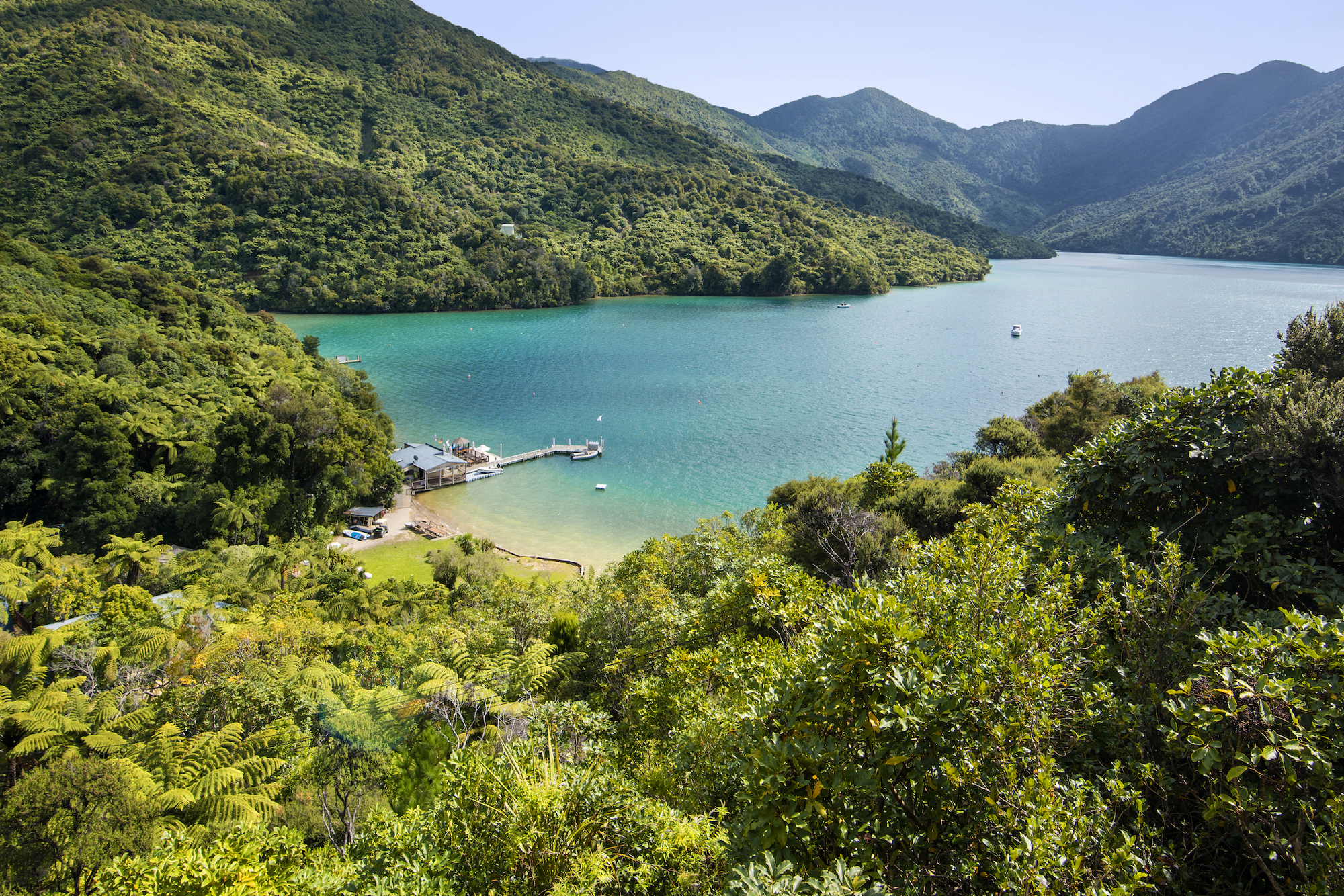
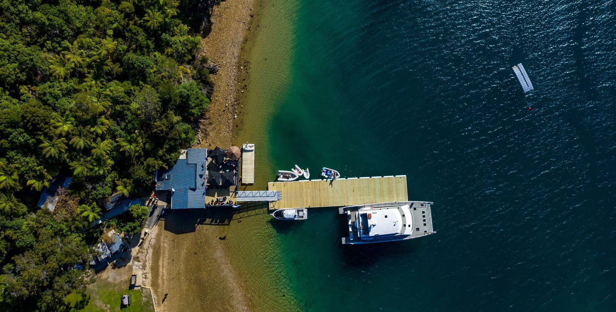
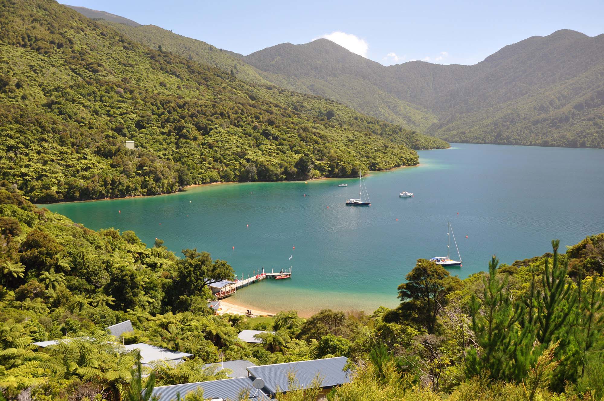
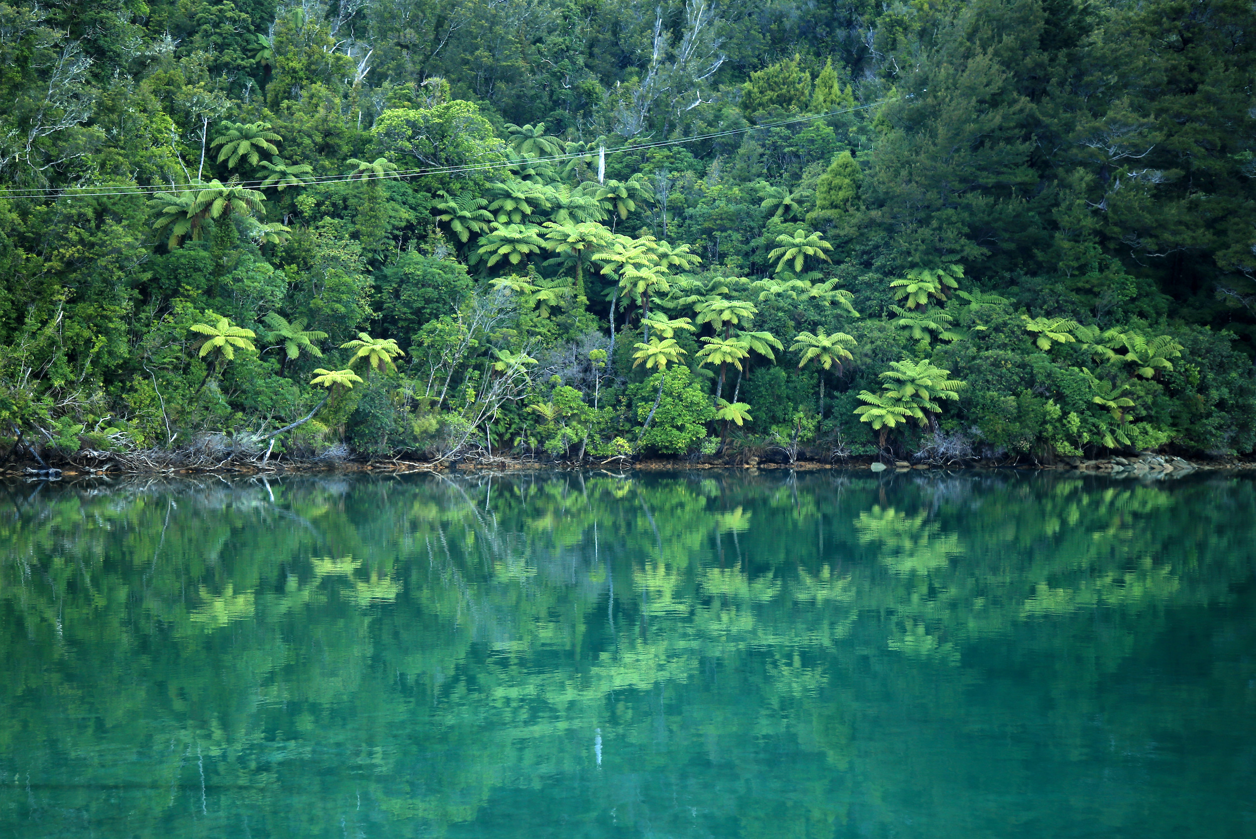
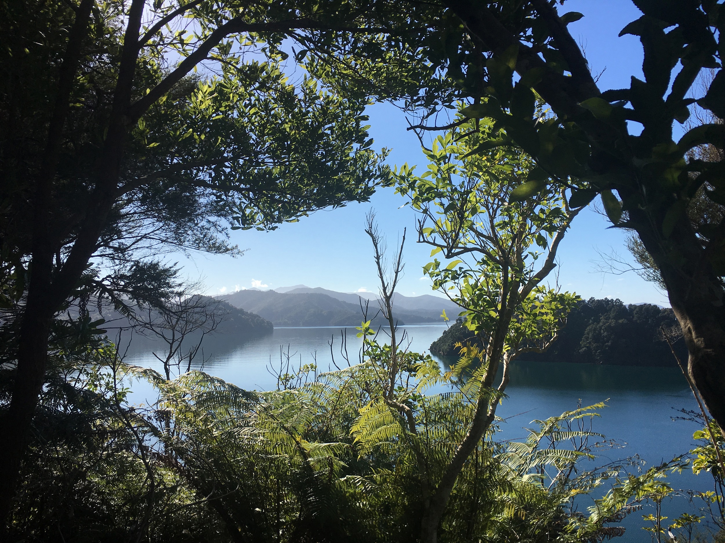
The Marlborough Sounds is clad in a huge variety of vegetation, including lush sub-tropical rainforest and native flora and fauna as seen here around Endeavour Inlet.

Much of the Marlborough Sounds was cleared for farming, but a number of conservation projects are now allowing native forest to regenerate.

Punga Cove owes its name to the plentiful punga ferns (tree ferns) that thrive in this high-rainfall area of the Sounds. There are also many rimu, matai and miro trees near the coast, while further away the red beech is predominant.

The Marlborough Sounds is a network of ancient drowned river valleys, with three main sounds: Queen Charlotte/Tōtaranui, Pelorus/Te Hoiere and Kenepuru.

Punga Cove is located on a piece of land that straddles the deep Queen Charlotte Sound/Tōtaranui and comparatively shallow Kenepuru Sound. There is a distinct difference between the water colour of the two sounds.

Ongoing downward tectonic movement means the Marlborough Sounds continue to slowly sink.

Learn more about our environment

 Kereru (native wood pigeons) often found frequenting the forests surrounding Punga Cove in the Marlborough Sounds in New Zealand's top of the South Island
 Kereru (native wood pigeons) often found frequenting the forests surrounding Punga Cove in the Marlborough Sounds in New Zealand's top of the South Island

Wildlife

Punga Cove is the perfect place to see the plentiful bird and marine life that call the Marlborough Sounds home.

You are almost guaranteed to encounter a cheeky and bold flightless weka during your stay, or on the Queen Charlotte Track. Local wildlife commonly seen includes weka, kererū (wood pigeon), tūī, pīwakawaka (fantail), kōtare (kingfisher) and the rare kawau pāteketeke (king shag).

In the water, we often see passing pods of dolphins, Little Blue Penguins, seals, eagle rays and stingrays and even the occasional orca or whale.

The highest peak in the Marlborough Sounds is Mt Stokes/Pororangi, at 1,203 metres. At its summit is a rare sub-alpine environment.

Marlborough Sounds soils consist mainly of clay over a base of greywacke rock, which account for the many slips visible on the hillsides.

View the beautiful sunset from behind the hills at Punga Cove in the Marlborough Sounds of New Zealand's top of the South Island

History

The Marlborough Sounds has a long history with Māori, who inhabited these sheltered waterways centuries before the first Europeans arrived.

Many myths and legends surround the Sounds, including the battle between the great navigator and warrior Kupe and Wheke the giant octopus. As Kupe fought Wheke in Cook Strait/Raukawa, the octopus tried to anchor himself to the earth and gouged out the Sounds’ complex land forms.

Many fortified settlements (pa) were built throughout the Marlborough Sounds as iwi (tribes) defended themselves against invaders. Of particular note was the warrior chief Te Rauparaha, who warred with tribes throughout the North and South Islands, and led raids against Marlborough Sounds Māori during the 1830s.

Spot birds and other wildlife flying around Punga Cove in the Marlborough Sounds in New Zealand's top of the South Island

The first European contact came with Captain James Cook, who found shelter and abundant food and water in nearby Ship Cove/Meretoto, located in Queen Charlotte Sound/Tōtaranui. Captain Cook returned there several times with his ships during his explorations of New Zealand over the next seven years. Endeavour Inlet and Resolution Bay were named after Cook’s ships.

Since Cook, the Sounds has seen many industries come and go including whaling, mining and pastoral farming. The latter resulted in the burning of much native forest, some of which is regenerating now.

Today, aquaculture is one of the Sounds’ main industries, particularly King salmon and Greenshell Mussels.

Local historic sites

  • SHIP COVE/MERETOTO
    The site where explorer Captain James Cook anchored his ships from 1770 is marked with a memorial and information panels. This is also the beginning of the Queen Charlotte Track and is visited often by water taxis and tour operators. Resolution Bay and Endeavour Inlet are named after two of Cook’s ships.
  • PICKERSGILL ISLAND/MATAPARA
    Located on the northern side of Arapaoa Island, Pickersgill Island/Matapara was named after the master’s mate on Cook’s ship the Endeavour.
  • EAST BAY
    This bay on Arapaoa Island was where Captain Cook released a buck and doe goat, which went on to establish a wild population that still exists today.
  • HIPPA ISLAND
    The largest Māori pa in Queen Charlotte Sound/Tōtaranui was once based here, at the southern tip of Motuara Island and had, according to Captain James Cook, 80-100 whare (houses) in 1770. By the time he returned eight years later, the pa was deserted. Given the rugged and exposed nature of the site, it is likely the pa was positioned for defence from outside tribes.
  • CANNIBAL COVE/ANAHO
    This Outer Sounds bay received its English name by Captain James Cook after the crew of the HMS Endeavour discovered human bones in the remains of a meal. Its Māori name, Anaho, means new bay or bay that runs deep. The bay supported a large settlement and had gardens and livestock. Captain Cook released a boar and sow at Cannibal Cove/Anaho which would later become a food source for Māori and European explorers.
  • MOTUARA ISLAND
    Besides being an important native bird sanctuary, Motuara Island is also a site of historical significance for both Māori, who populated Hippa Island at Motuara’s southern end, and early Europeans. Captain Tobias Furneaux, who captained the Endeavour’s sister ship, the Adventure, established a hospital and gardens on the island. Captain Cook built an edifice on the island to record his visit and covered it with a Union Jack, proclaiming British Sovereignty over the South Island. Today, Motuara Island is an important bird sanctuary and home to saddleback/tīeke, South Island robin/toutouwai, yellow-crowned parakeet/kākāriki and Maud Island frog. It is also used as a crèche for rowi kiwi, which are only found in South Ōkārito Forest, near Franz Josef. Rowi have been decimated by stoats – fewer than 500 are left. Eggs are hatched in captivity and the chicks transported to Motuara Island. Once they weigh 1kg they can defend themselves from stoats and are returned to the wild.
  • LONG ISLAND – KOKOMOHUA MARINE RESERVE
    Captain Cook also had gardens on Long Island and introduced potatoes, parsnips, carrots and turnips to local Māori to supplement their kumara (sweet potato) crops. During World War 2, an anti-submarine signal station was built at Long Island. Many other defence structures were built in Queen Charlotte Sound/Tōtaranui during that time, including on nearby Blumine Island/Oruawairua and in Tory Channel/Kura te Au, many of which are still visible today.